


OsmAnd — Maps & GPS Offline


Description of OsmAnd — Maps & GPS Offline
OsmAnd হল OpenStreetMap (OSM) এর উপর ভিত্তি করে একটি অফলাইন বিশ্ব মানচিত্র অ্যাপ্লিকেশন, যা আপনাকে পছন্দের রাস্তা এবং গাড়ির মাত্রা বিবেচনা করে নেভিগেট করতে দেয়। ইনলাইনের উপর ভিত্তি করে রুট পরিকল্পনা করুন এবং ইন্টারনেট সংযোগ ছাড়াই জিপিএক্স ট্র্যাক রেকর্ড করুন।
OsmAnd একটি ওপেন সোর্স অ্যাপ। আমরা ব্যবহারকারীর ডেটা সংগ্রহ করি না এবং আপনি সিদ্ধান্ত নেন যে অ্যাপটি কোন ডেটাতে অ্যাক্সেস পাবে।
প্রধান বৈশিষ্ট্য:
মানচিত্র দেখা
• মানচিত্রে প্রদর্শিত স্থানগুলির পছন্দ: আকর্ষণ, খাদ্য, স্বাস্থ্য এবং আরও অনেক কিছু;
• ঠিকানা, নাম, স্থানাঙ্ক বা বিভাগ দ্বারা স্থান অনুসন্ধান করুন;
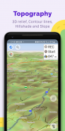
• বিভিন্ন ক্রিয়াকলাপের সুবিধার জন্য মানচিত্রের শৈলী: ট্যুরিং ভিউ, নটিক্যাল ম্যাপ, শীত এবং স্কি, টপোগ্রাফিক, মরুভূমি, অফ-রোড এবং অন্যান্য;
• শেডিং রিলিফ এবং প্লাগ-ইন কনট্যুর লাইন;
• একে অপরের উপরে মানচিত্রের বিভিন্ন উত্স ওভারলে করার ক্ষমতা;
জিপিএস নেভিগেশন
• একটি ইন্টারনেট সংযোগ ছাড়া একটি জায়গায় একটি রুট প্লট করা;
• বিভিন্ন যানবাহনের জন্য কাস্টমাইজযোগ্য নেভিগেশন প্রোফাইল: গাড়ি, মোটরসাইকেল, সাইকেল, 4x4, পথচারী, নৌকা, পাবলিক ট্রান্সপোর্ট এবং আরও অনেক কিছু;
• নির্দিষ্ট রাস্তা বা রাস্তার পৃষ্ঠের বাদ দেওয়ার বিষয়টি বিবেচনায় নিয়ে নির্মিত রুট পরিবর্তন করুন;
• রুট সম্পর্কে কাস্টমাইজযোগ্য তথ্য উইজেট: দূরত্ব, গতি, বাকি ভ্রমণ সময়, ঘুরতে দূরত্ব এবং আরও অনেক কিছু;
রুট পরিকল্পনা এবং রেকর্ডিং
• এক বা একাধিক নেভিগেশন প্রোফাইল ব্যবহার করে পয়েন্ট দ্বারা একটি রুট পয়েন্ট প্লট করা;
• জিপিএক্স ট্র্যাক ব্যবহার করে রুট রেকর্ডিং;
• GPX ট্র্যাকগুলি পরিচালনা করুন: মানচিত্রে আপনার নিজস্ব বা আমদানি করা GPX ট্র্যাকগুলি প্রদর্শন করা, সেগুলির মাধ্যমে নেভিগেট করা;
• রুট সম্পর্কে ভিজ্যুয়াল ডেটা - অবতরণ / আরোহণ, দূরত্ব;
• OpenStreetMap-এ GPX ট্র্যাক শেয়ার করার ক্ষমতা;
বিভিন্ন কার্যকারিতা সহ পয়েন্ট তৈরি করা
• প্রিয়;
• চিহ্নিতকারী;
• অডিও/ভিডিও নোট;
OpenStreetMap
• OSM এ সম্পাদনা করা;
• এক ঘন্টা পর্যন্ত ফ্রিকোয়েন্সি সহ মানচিত্র আপডেট করা;
অতিরিক্ত বৈশিষ্ট্য
• কম্পাস এবং ব্যাসার্ধ শাসক;
• ম্যাপিলারি ইন্টারফেস;
• রাতের থিম;
• উইকিপিডিয়া;
• বিশ্বজুড়ে ব্যবহারকারীদের বিশাল সম্প্রদায়, ডকুমেন্টেশন এবং সমর্থন;
প্রদত্ত বৈশিষ্ট্য:
মানচিত্র+ (অ্যাপ বা সদস্যতা)
• অ্যান্ড্রয়েড অটো সমর্থন;
• সীমাহীন মানচিত্র ডাউনলোড;
• টোপো ডেটা (কনট্যুর লাইন এবং ভূখণ্ড);
• নটিক্যাল গভীরতা;
• অফলাইন উইকিপিডিয়া;
• অফলাইন উইকিভ্রমণ - ভ্রমণ নির্দেশিকা।
OsmAnd Pro (সাবস্ক্রিপশন)
• OsmAnd ক্লাউড (ব্যাকআপ এবং পুনরুদ্ধার);
• ক্রস-প্ল্যাটফর্ম;
• ঘন্টায় মানচিত্র আপডেট;
• আবহাওয়া প্লাগইন;
• উচ্চতা উইজেট;
• রুট লাইন কাস্টমাইজ করুন;
• বাহ্যিক সেন্সর সমর্থন (ANT+, ব্লুটুথ);
• অনলাইন এলিভেশন প্রোফাইল।
OsmAnd — Maps & GPS Offline - Version 4.9.10
(14-12-2024)

OsmAnd — Maps & GPS Offline - APK Information
APK Version: 4.9.10Package: net.osmandLatest Version of OsmAnd — Maps & GPS Offline
Other versions


Apps in the same category

You may also like...


